Water, Sewer and Drainage Map Report
Contents
Article Summary
A Water and Drainage Map search provides you with a detailed map and legend showing the routes of underground water, drainage and sewerage pipes, details of manhole positions and other such assets. There is also a detailed report dealing with water quality and providing replies by the Water Authority to standard questions asked by a person who would be considering the purchase of a property. The article provides details of the search fees, which differ with each local authority. The search can be purchased direct from the article, if required.
Residential and Commercial Reports
The Water Authorities distinguish between reports obtained for residential and commercial purposes.
Residential Report
Our homes and the land they are built upon have water, drain and sewers passing beneath them. Knowing the route of the water, drain and sewer pipes and where they can be accessed via manholes and inspection chambers can be very helpful, particularly when you are considering the erection of another property on your land, or when you believe you have a water or sewerage leak. Sometimes, you just need to know the position of the nearest water access point in the road outside of your house. The map and reports deal with water, sewers and drains located at your property and within 200 metres of it.
Commercial Report
A commercial report is slightly different from a residential report, as commercial users are now able to chose their own water retailer. Furthermore, trade premises to do not have the right to discharge trade effluent to the public wastewater network, without consent. Accordingly, the commercial report has to consider these and other additional matters.
Report & Maps of Your Water, Drain & Sewer Routes
The Report and Map that we provide is specifically for your property and includes the following:
- Replies by the Water Authority based on questions prepared by The Law Society on their CON29DW form. These deal with drainage, water and charges.
- A detailed extract from the Public Sewer Map showing the public sewers, disposal mains and lateral drains in the vicinity of your property.
- A detailed extract from the Waterworks Map showing the water mains, resource mains or discharge pipes in the vicinity of your property.
- Risk of internal flooding due to overloaded public sewers.
- Water Supply classification for your property.
- The route of Culverts, where there are any, are also shown.
The report includes detailed legends explaining the symbols used on the maps. In all the average length of a report for a residential property is between 20 and 30 pages. We also provide reports for commercial properties.
Water, Drain and Sewer Maps
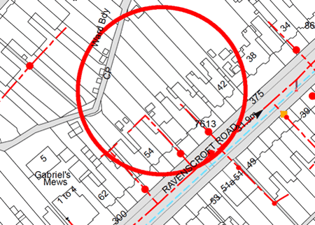
Sample extract of Sewer Map
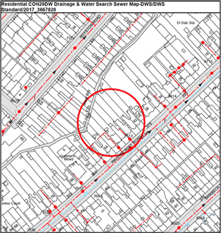
Zooming in for the detail, the red circle centres upon the property being searched
Most Water Authorities take 3-5 working days to deliver the report, which is normally received electronically and sent to you by Email.
Environment Agency Flood Risk Report
The most comprehensive and detailed Flood Risk report available, providing information supported by detailed maps for Sea and River Flooding, Rainwater Flooding and Groundwater Flooding.
£54.95Land Registry Flood Risk Indicator
This is a 1 page brief overview of flood risks for an individual registered property.
£9.95Searching by map
We can identify land and buildings with pin-point accuracy even where there is no address. Our application form contains a built in map that allows you to mark or outline the land.
£29.95


Links from this page
- Environment Agency Flood Risk Report
- Land Registry Flood Risk Indicator
- Flood Warning Information Service
Help and Support
Information Hub Search
Was your question answered?
If you have any further questions regarding any of our products or services please feel free to contact us.
Land Registry Services are leading specialists in property data, conveyancing documents and environmental reports. Land Registry Services is neither owned or operated by the UK Government.