How to find out who owns land?
Contents
Article Summary
The most efficient way to find out who owns land is to use an online mapping utility such as our portal, which enables you to identify property by several different means, title number, address or map, making it incredibly simple, quick and efficient. We are usually able to provide you with your requested information within an hour after placing your order.
Identifying a Property to obtain a copy of the Title Register
Identification of a property, when applying for a Land Registry search, is generally carried out in one of two ways:
- By Postal Address
- By Title Number (where this is known)
The majority of people do not know the Title Number, and instead use the postal address.
When a Property does not have a Postal Address
There are a number of ways to identify a property not having a postal address, but some of these methods have been over-taken by more modern and efficient means.
Older methods involved obtaining a large scale OS map, which usually required a trip to a specialist commercial stationer or map vendor, and attaching this to an application form.
The most efficient way, today, is to use an online mapping utility such as that provided by Google. Although you could print off the map, mark the land you are interested in, and then send it to the Land Registry with an application form, there is now a far more efficient way of doing this.
Application form with Map Utilities built-in
We have 2 map utilities built into our application form. The first of these, our standard map, requires you to drag an online pin onto the land. This is fine for small parcels of land. Where the land is larger, encompassing many areas of ownership, you would use our advanced map, which enables you to trace the outline of the land in question. When you submit your application form, we receive it with a copy of the marked map. From this we can quickly identify the land and obtain the Title Register for you.
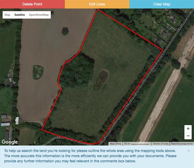
Below is a copy of a completed Advanced Map Search, clearly identifying the fields to be searched.
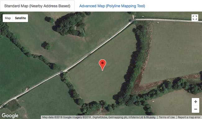
Below is a completed standard map search, identifying one field only to be searched.
Vacant, Derelict or Ruinous Properties
It is likely that a non-residential property that has been vacant for a long time, a derelict or a ruinous property, will no longer have a post code. In such cases you would need to use our standard map search.
We offer the following Map-based Land Registry Searches:
Single Plots of Land
This search enables you to obtain the ownership details of a single plot of land, either by dropping a pin onto a built-in map on our application form, or by tracing its outline onto the map.
£29.95Large Areas of Land
This search enables you to obtain the ownership details of a large area of land, whatever its nature, size or shape. Our fee includes the Title Registers for the first 5 Titles. You will be advised of the cost of proceeding with any remaining Titles, which will be charged at £4.95 each.
£89.95Woodland Searches
This search enables you to obtain the ownership details of a parcel of woodland, forest or moorland. If more than one Title is discovered you will be advised of the cost of obtaining further Titles.
£29.95


Links from this page
Help and Support
Information Hub Search
Was your question answered?
If you have any further questions regarding any of our products or services please feel free to contact us.
Land Registry Services are leading specialists in property data, conveyancing documents and environmental reports. Land Registry Services is neither owned or operated by the UK Government.